| Route description: Beinn Achaladair & Beinn a'Chreachain Munros included on this walk: Beinn a'Chreachain and Beinn Achaladair Time taken: 6.3 hours Distance: 19km Ascent: 1244m |
Well as predicted in my last walk report the wall to wall sunshine was due to end and be replaced with thunderstorms and the threat of localised flooding later today ! There was a forecast of a few hours of sunshine in the morning though and a good chance of cloud free summits so we decided we'd take the chance. Leaving Perth at around 6.00, Wullie, his mountain dog Indie and I made good time and arrived at the car park just off the A82 at the end of Loch Tulla (signposted Achaladair Farm) at around 7.30 There was some confusion as the Walkhighlands GPX waypoints start about 200m further up the road. It seems there used to be a parking area right next to the farm before it was moved further back, once we realised we were in the right place the boots were quickly on and we made our away along the road towards the farm and the area where the old car park was situated. The skies at this point where completely blue with just the odd wee fluffy white cloud floating about. It was also very warm and muggy and didn't take long before it became uncomfortably so !
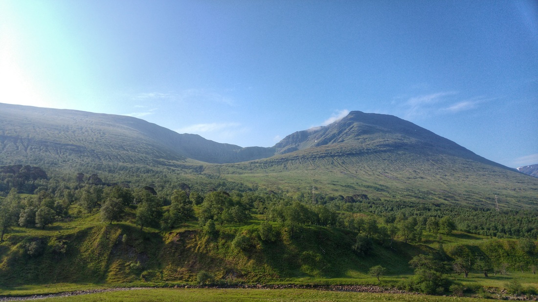
We decided we would complete the round in a clockwise direction so we ignored the signpost pointing towards the 'hill path' (it becomes the return path) shortly after leaving the car park and headed towards the the ruins of an old tower at the farm. Here you carry straight on, there is a sign stating pedestrian access to Gorton. The going was good underfoot along the 'landrover' track and we soon reached the Allt Ur, there was hardly any water in it and it was easily crossed. Further on there is a bridge which allows you to cross the 'Water of Tulla' and stay on the track which runs alongside the river, adjacent to the woods, which is the much drier side of the river. The early views of the two hills we were tackling were superb in the early morning sun.
We decided we would complete the round in a clockwise direction so we ignored the signpost pointing towards the 'hill path' (it becomes the return path) shortly after leaving the car park and headed towards the the ruins of an old tower at the farm. Here you carry straight on, there is a sign stating pedestrian access to Gorton. The going was good underfoot along the 'landrover' track and we soon reached the Allt Ur, there was hardly any water in it and it was easily crossed. Further on there is a bridge which allows you to cross the 'Water of Tulla' and stay on the track which runs alongside the river, adjacent to the woods, which is the much drier side of the river. The early views of the two hills we were tackling were superb in the early morning sun.

Beinn a'Chreachain hidden behind Meall Bhuide in the centre. Beinn Achaladair on the right.
Beinn a'Chreachain ridge high above the lochan.
Already sweating hard as we continued along the track we reached a way marked post pointing back down to the spot on the river we should cross. There used to be a bridge to cross here but although parts of it remain, it is now in ruin. I certainly wasn't going to attempt crossing it ! The river was easily crossed as the water level was really low, despite me doing my best 'Bambi on ice' routine as I stepped from rock to rock....much to Wullie's amusement ! I would have serious doubts that you'd be able to cross at all if the river was in spate. That being the case you could stay on the other side of the water, earlier on, on the outward route. After crossing the river the going underfoot does become boggier as you head up through the Black Wood of Rannoch. Given the dry conditions of late I suspect the usual 'bogginess' would be much more troublesome.

Best of luck putting your weight on that !!
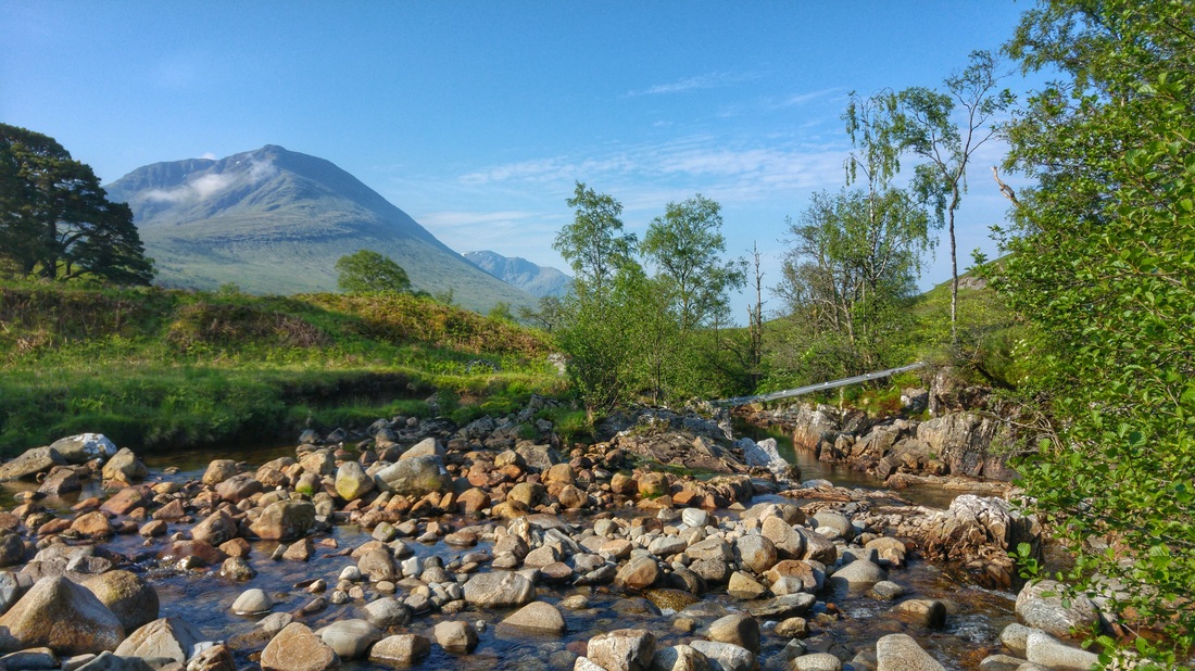
Beinn Achaladair beyond the remains of the bridge. Note the low water level.
There is no real path at this point so we just made our way across the driest parts heading for the small and low underpass underneath the railway line. I'm 6' 3" and managed to get through with a stoop. From here we followed the clearly defined path alongside the deer fence ignoring the two stiles and waymarked posts (I presume these are for a low level walk). The view back to Achaladair from here was simply stunning. At the end of the deer fence the path continues alongside the cascading stream coming from Lochan a'Chreachain, with it's lovely wee waterfalls, up into Coire an Lochain. Our next target was to head SE up to the saddle on the left of the crags skirting the lochan, that means crossing the stream. Again the crossing was easy, it's just a case of finding a spot that takes your fancy.
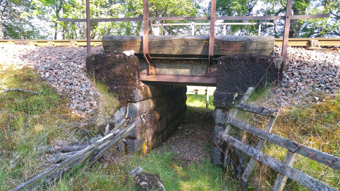
Mind your head !
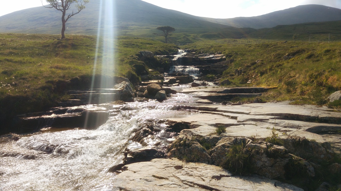
Lovely cascading stream you follow up to the Lochan.
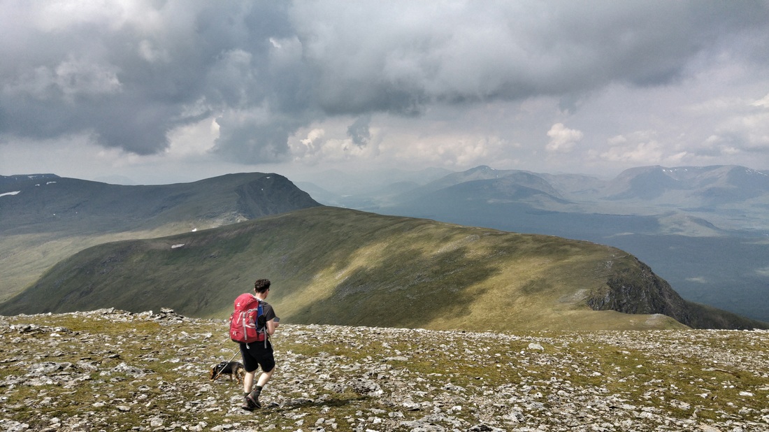
The sun was really beating down now and seemed to have led to the hatching of millions of Daddy Long Legged type insects, literally every step appeared to send another squadron up into the air....up your nose, in your ears....you get the drift ! I had stripped down to shorts and laggered on the sun block by this stage but the 'slog' up the spongey, open slopes was extremely hard going. It felt as though we weren't really getting anywhere. The views behind across Rannoch Moor would ordinarily have been fantastic, however, some menacing black clouds and a general grey 'rainy' haze had begun to develop all over the North. What we didn't realise at this point was that we were approaching the same coming from the South beyond the ridge. After about 3 hours since leaving the car we finally reached the top of the ridge with no shortage of relief. Although the longer distance views were obscured, we were treated to a fantastic viewpoint of the stunning wee lochan, cradled by the corrie headwall round to the smaller peak of Meall Buidhe. The ridge is about the 900m mark which meant it was now only a short, quick hop up to today's first summit of Beinn a'Chreachain.
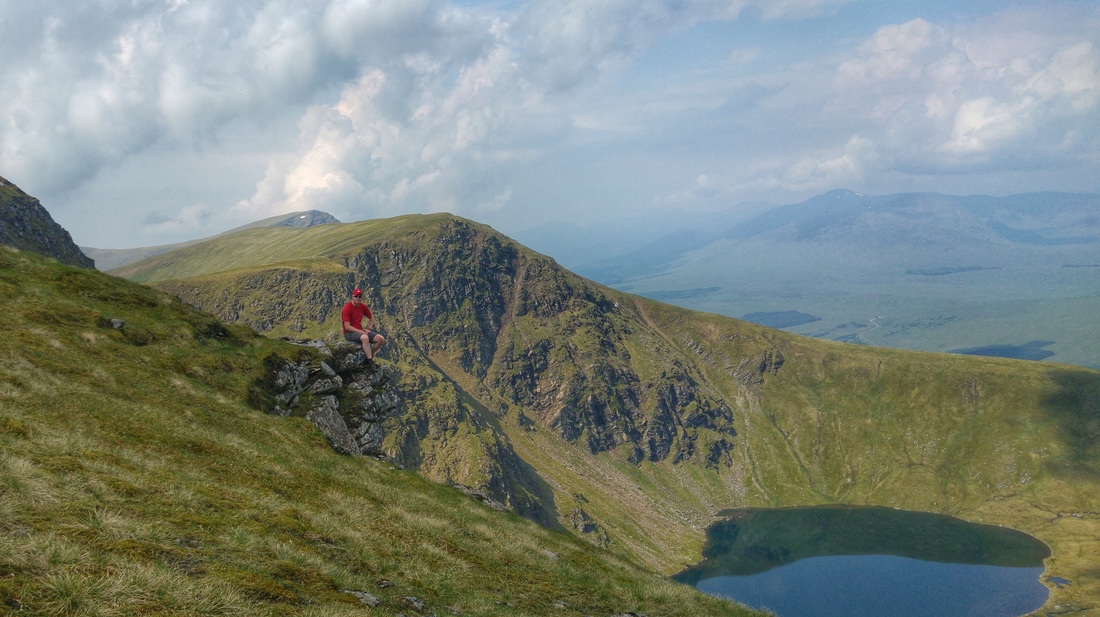
Sitting high above the cracki' wee lochan.
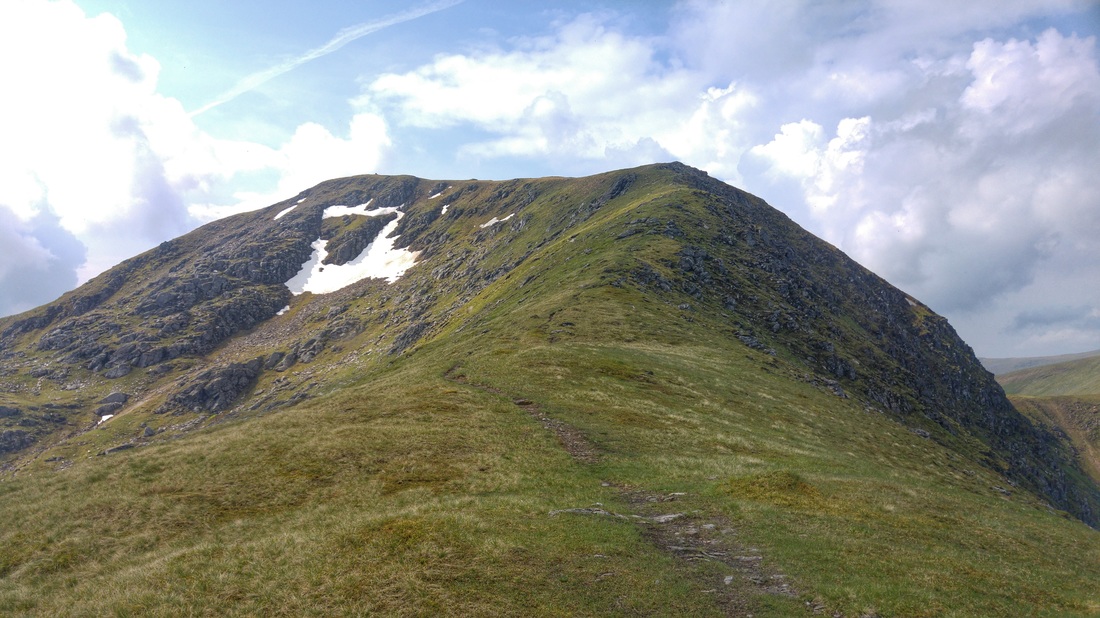
The final few hundred metres to the summit.
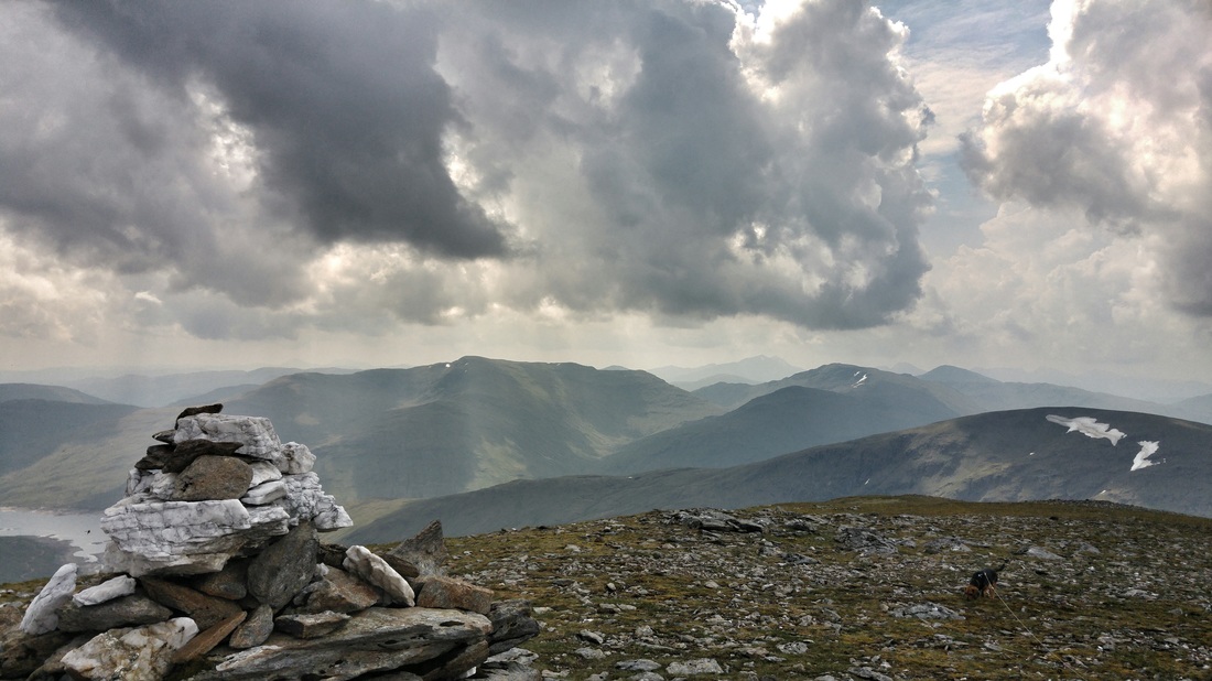
As we reached the summit it became apparent just how lucky, or unlucky given the effort required to get up here, we had been with the weather. The only real remaining blue skies were right above us. We were basically surrounded on all sides by dark, brooding skies. The summit of Beinn a'Chreachain would be a fantastic viewpoint in better visibility, as it was the views we did have were fantastic in their own right. The dark vistas providing a much different perspective on Scotland's mountains than those enjoyed by much of our community in the last couple of weeks. As we sat down for a well earned bite to eat we began to hear the first rumblings of thunder. At this point we were resigned to the fact that in all likelihood the sun hats would soon have to be replaced by waterproofs. As the menacing weather closed in around us I was reminded of George Clooney's characters famous quote in 'The Perfect Storm'...."she's not gonna let us out" !!

SE over the end of Loch Lyon.
....and again.

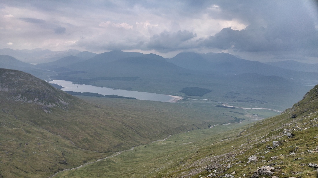
West over Rannoch Moor to the Black Mount Munros.
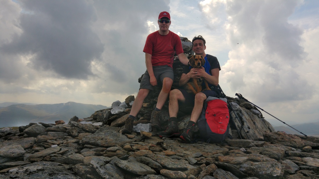
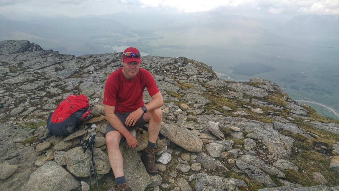
Beinn a'Chreachain summit selfie.
Clearly this was turning into a day where you didn't want to be hanging about high on the mountain tops. We were soon on the move down towards the bealach with the neighbouring summit of Meall Buidhe. As we headed up and over the hump of Meall Buidhe we began to feel the first spots of light rain, looking to the heavens, amazingly the brightest of the darkening skies still remained above us. Could we really be that lucky ? Quickly tramping over Meall Buidhe we were soon descending off the ridge to the Bealach an Aoghlainn at the foot of Beinn Achaladair. We were greeted at the foot of the mountain with a flash of lightening and a loud clap of thunder. First time I've been applauded on the hillside ! The initial ascent from this point looked terribly steep up the rocky slope. It was. However, there is nothing like the threat of impending vaporisation to motivate the weary legs to get their arses up the hill as quickly as humanly (doggedly for Indie) possible. Thankfully, higher up the slope eases and curves round to the right for the final climb up to Beinn Achaladair's summit. On the premise that lightening was likely to take the shortest path to earth I noticed Wullie appeared to have developed a curious, stooped walking style on his approach to the final summit ! At 1036 metres the position of the cairn right by the edge of the northern precipices, like the last summit, would make an excellent viewpoint in better conditions. The actual summit is further along the ridge and is a paltry 2 metres higher, marked by an unspectacular and tiny cairn.
The walk ahead between the two summits.
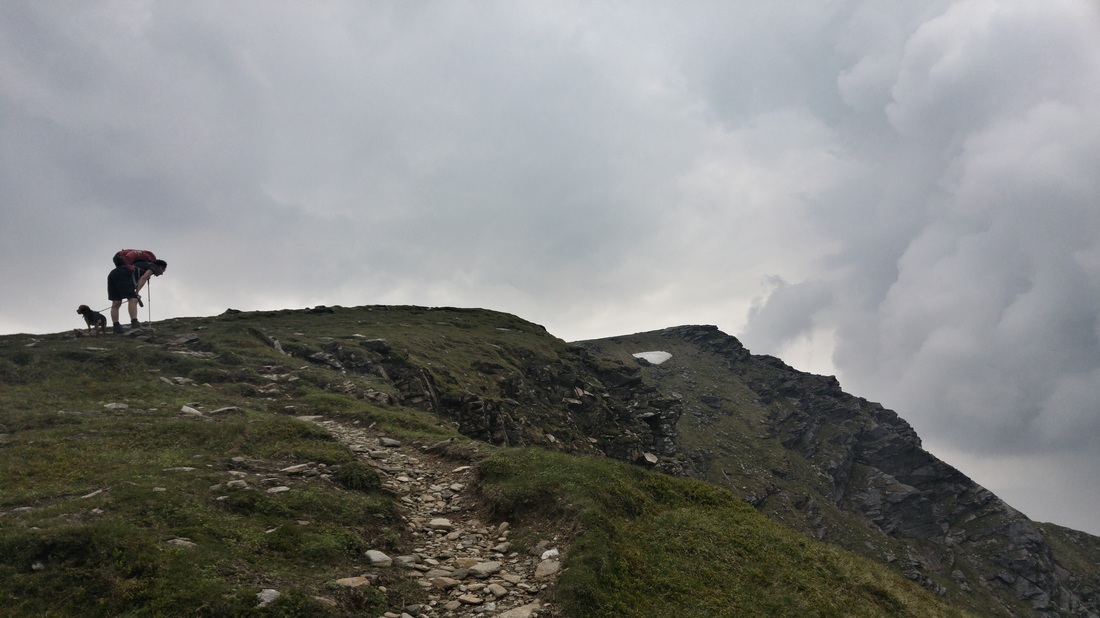
Something wrong with your back Wullie ?
The summit of Beinn Achaladair was reached quickly, and to be honest would be without the fear of the weather spurring you on. The views from the summit had become restricted further by the dark clouds and the thunder and lightening had continued unabated and now sounded very close indeed. There was literally nowhere to shelter up there, the quickest of summit photos were taken before we were on our way along the gentle grassy ridge which gradually curves round to the South to the bealach above Coire Daingean. A few metres along the ridge our luck ran out and the heavens opened. The rapid, panicked actions of grown men trying to dress themselves in as little time as possible inevitably led to a scene reminiscent of something from a Benny Hill sketch ! Eventually some items were off, some half off ! but most importantly waterproofs were on.
As we reached the head of the corrie the bulk of Beinn an Dothaidh towers above you. Apparently some people include this Munro in their round. We had already climbed it but if we hadn't I can assure you it would have remained unclimbed today !
As we reached the head of the corrie the bulk of Beinn an Dothaidh towers above you. Apparently some people include this Munro in their round. We had already climbed it but if we hadn't I can assure you it would have remained unclimbed today !

Loch Tulla from the first 'false' summit cairn on Beinn Achaladair.
True summit selfie......"right, let's get to &*£% out of here" !!
A decent, if rocky, path descends north from the bealach, mirroring the stream down through the rough hummocky and at times marshy ground of Coire Achaladair. Unfortunately we were able to see right down the glen to the tiny speck of the farmhouse at the start of the route. There was nothing else for it but to march our way out, feeling slightly more reassured about the threat from above with every step. Half way down the glen the rain eased and as I didn't immediately remove the waterproofs as I was soon soaking anyway as I sweated my way down through the muggy conditions which had returned. Eventually the path reached the bottom of the glen where it crosses the railway via a quaint little bridge in a picturesque patch of woodland. As we continued down the path there was a strange sound coming from the direction of the railway, as we looked round we were treated to the bizarre scene of a service Landrover on train wheels making it's way up the line ! The path takes a left turn (signed) a fair distance before the farmyard to return you to the car park down the path ignored at the beginning of the day. At the end of a long walk the last few steps are an effort, not helped by the realisation that Wullie's 4x4 still looked like a Fiat 500 from this distance. We made it back in just over 6 and a half hours. This was a great couple of hills and would have been sensational had the weather held. As we all know, you can't win them all. Numbers 69 & 70 in the bag for me. 91 & 92 for Wullie and 9 for young Indie.
The long walk out through Coire Achaladair.
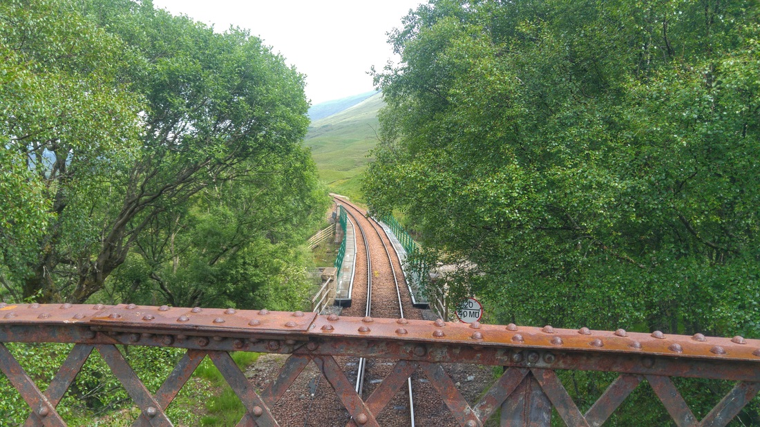
Bridge over the railway line.....what is that funny looking train ?!?
 RSS Feed
