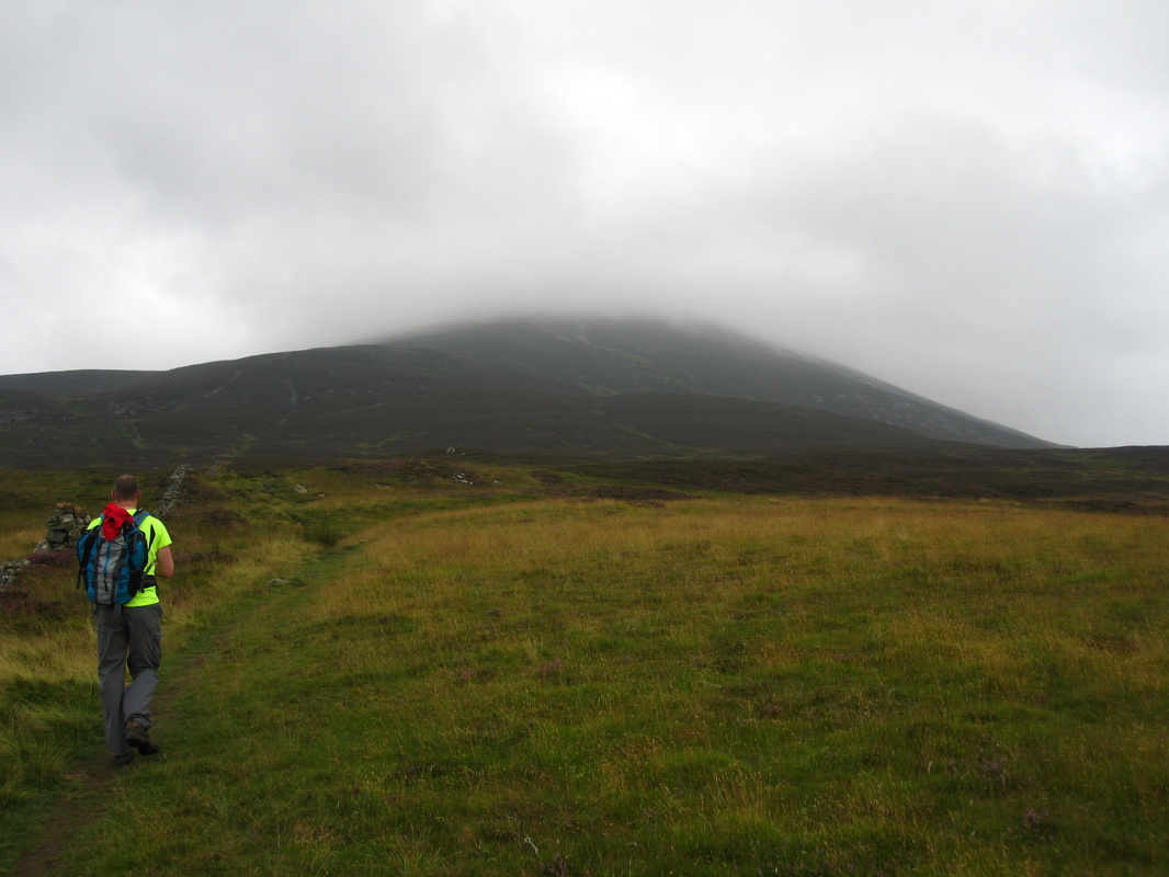
| Route: Beinn a'Ghlo Munros: Braigh Coire Chruinn-bhalgain, Carn Liath (Beinn a'Ghlo), Carn nan Gabhar Time taken: 8 hours Distance: 22km Ascent: 1239m |
....No.
My luck had finally run out. Every other walk report I had posted had been adorned with blue skies and fantastic views. Not this time, what follows is my less libidinous version of 50 Shades of Grey. I could have achieved the same result by sticking my head in an empty filing cabinet for 8 hours
My luck had finally run out. Every other walk report I had posted had been adorned with blue skies and fantastic views. Not this time, what follows is my less libidinous version of 50 Shades of Grey. I could have achieved the same result by sticking my head in an empty filing cabinet for 8 hours
Setting the scene for what lies ahead (shade 1)
We arrived in the Loch Moraig layby around 07.45, joining an overnighting campervan. My apologies to the occupants for their no doubt rude awakening as my mate inadvertently leaned against the horn as he retrieved the OS map from the front seat
Following the Walk Highlands route we quickly arrived at the wooden hut marking the start of the approach path to today's first Munro, Carn Liath. What the description did not state was just how boggy the approach was. I rapidly began to regret the 'school boy error' to leave my gaiters in the house The path up the mountain is quite distinct, very, very steep and scree like. As we gained height we quickly lost any views back towards Loch Moraig, it was clear that we were not going to be rewarded with great views from the first summit of the day. The forecast from MWIS indicated that the cloud base would be around 700m, with strong winds gusting to 45mph...they were correct. What they were less accurate about was that the cloud would lift as the day wore on....unless of course by 'lift' they meant 'thicken'
Following the Walk Highlands route we quickly arrived at the wooden hut marking the start of the approach path to today's first Munro, Carn Liath. What the description did not state was just how boggy the approach was. I rapidly began to regret the 'school boy error' to leave my gaiters in the house The path up the mountain is quite distinct, very, very steep and scree like. As we gained height we quickly lost any views back towards Loch Moraig, it was clear that we were not going to be rewarded with great views from the first summit of the day. The forecast from MWIS indicated that the cloud base would be around 700m, with strong winds gusting to 45mph...they were correct. What they were less accurate about was that the cloud would lift as the day wore on....unless of course by 'lift' they meant 'thicken'
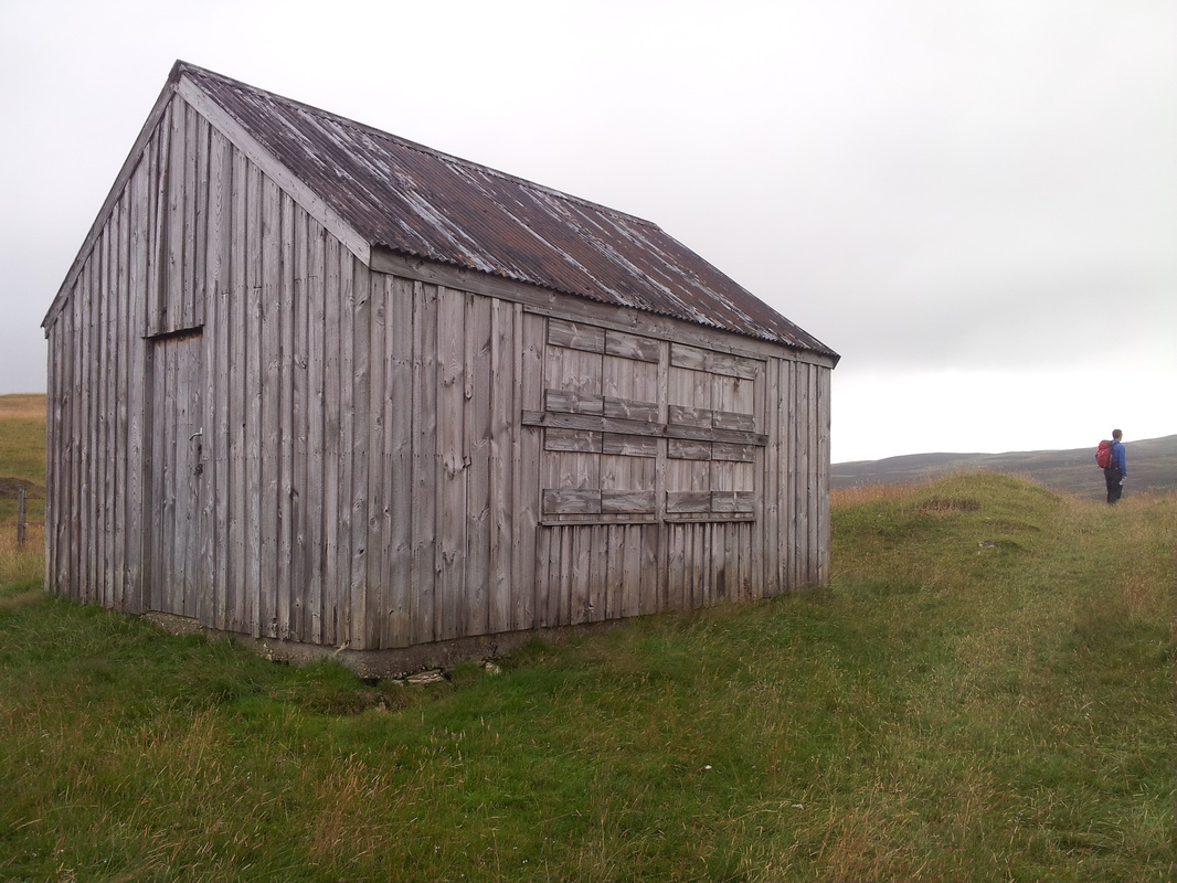
The wooden hut (shades 2-8)
The boggy approach (trousers, shade 9)
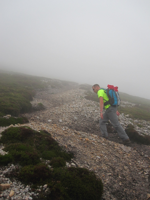
Very steep scree path (shades 10-20)
We soon found ourselves enveloped in the thick clag, as I stated before this was a first for us and the masochist in me welcomed the opportunity to find out if Steve Fallon's navigation tutelage would prove sufficient. What became apparent when up on the ridges was how extremely difficult it is to maintain the correct bearing when you can't see anything ahead of you to aim for.
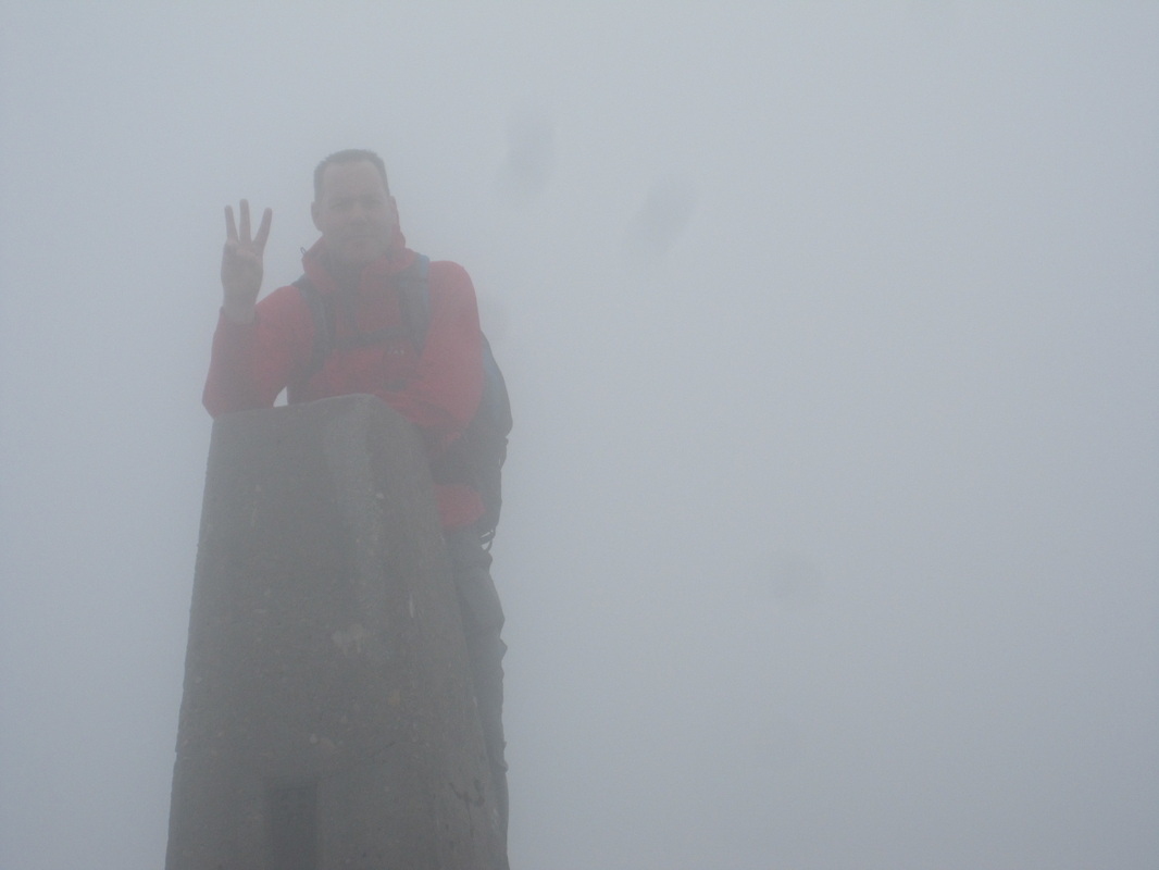
Around 90 mins saw the the trig point loom into view, we quickly skirted by it and headed for the summit cairn and a bit of the shelter from the increasing strength of the wind.
Around 90 mins saw the the trig point loom into view, we quickly skirted by it and headed for the summit cairn and a bit of the shelter from the increasing strength of the wind.
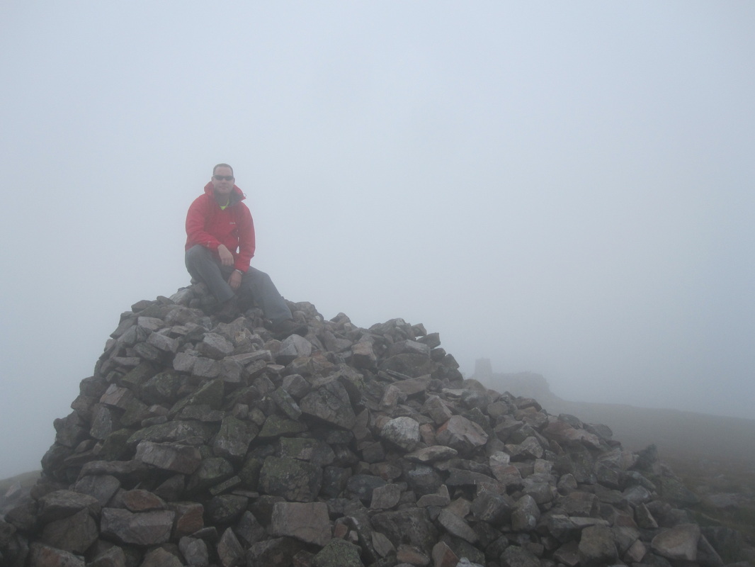
Carn Liath summit cairn, trig in the background (shades 21-25)
After a brief cuppa we resigned ourselves to the fact that the much anticipated ridge walk over to the second Munro of Braigh Coire Chruinn-bhalgain would not herald the breathtaking views we had envisaged. As disappointing as this was, hey-ho we were still out in the hills, it wasn't overly cold and no rain as yet and we had already agreed that we would have to return on a more favourable day.
Strangely the extremely poor visibility made the navigation across the meandering ridge fairly straightforward. It's hard to describe but basically when heading along the ridge correctly you could see the darker shape of the ground in front of you, whilst an incorrect bearing meant you were heading towards the distinctly lighter grey of the clag and eventually of the edge of the ridge. It was almost like the buffers on the kids 10 pin bowling lanes.....I know I did say it was hard to explain ! This circumstance actually did cause us a slight problem which I'll allude to later.
It wasn't long before we reached the bealach and began another steep climb toward BCCB's summit cairn. Here the conditions had deteriorated badly. The wind was extremely strong, although it was not raining we were getting quite wet due to the moisture in the air. We managed to find a little shelter for some refuelling, no mean feat given the relatively small cairn.
The bealach between CL & BCCB during a very brief moment of claity (shades 26-30)
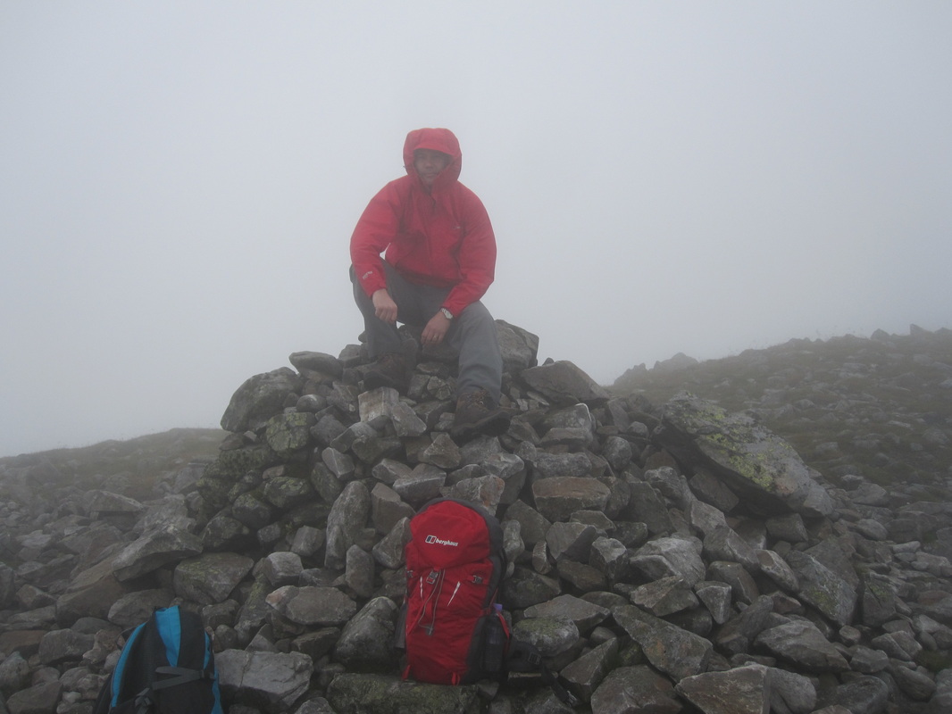
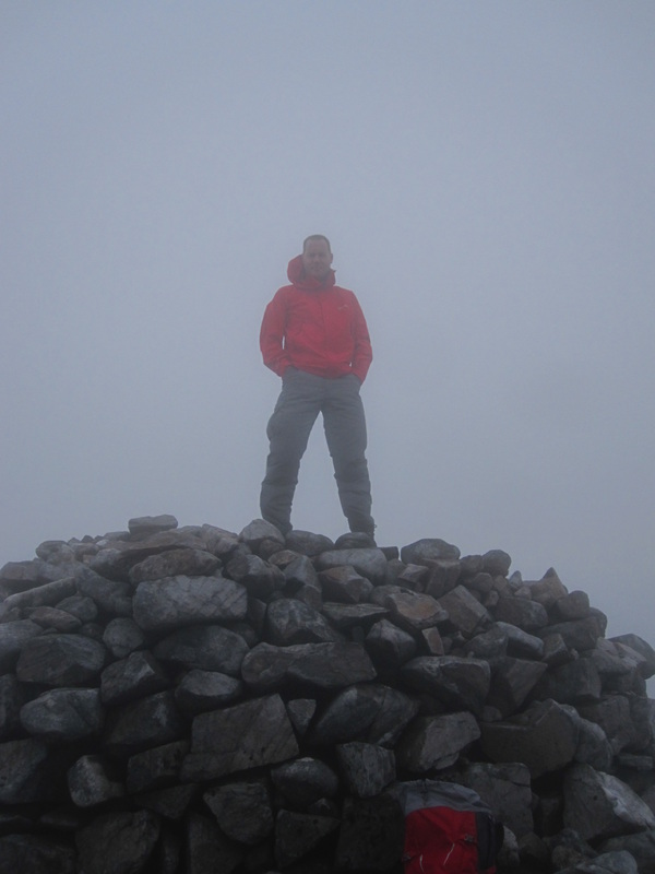
Summit cairn Braigh Coire Chruinn-bhalgain (shades 31-35)
As the shelter and views were 'limited' to say the least there seemed little point in hanging about. This is where I made my first navigational error by heading too far in a Northerly direction missing the path from the lower height that heads of to the bealach in the East (the ridge extended North beyond the point I should have turned right and the effect I described earlier suggested I was OK as I was still heading safely along the ridge, albeit too far !) A quick check of our position with Viewranger soon confirmed our suspicions that something wasn't quite right and we were soon heading back in the direction of the 1016m spot height. We picked up the stony path and follwed it down the steep descent into Bealach an Fhiodha. The ascent to the 3rd of Beinn a'Ghlo's Munros was quite uninspiring given the conditions and the wearying legs, however, in for a penny in for a pound. The going was quite tough over the boulders when on the ridge which houses a large cairn, a trig point and finally another large cairn marking the summit of Carn nan Gabhar at 1129m, the highest of the 3
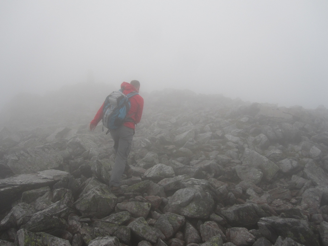
One of the many boulder fields (shades 36-40)
Carn nan Gabhar trig, I'd forgotten this was not the summit (shades 41-45)
Trying to look 'hard' and defy the conditions at the summit cairn of CNG (shades 31-35 again !)
Fortunately, the large summit cairn on CNG provided excellent respite from the wind and allowed us to finish off the tea and sandwiches in relative comfort. I don't mind admitting that as I sat there I had no real appetite to venture back out again especially given the fabled horrendous 'walk out'. But after 10/15 mins venture out we did. We did meet another walker at this point making his way up CNG, isn't amazing how much better you feel when you realise you are not the only halfwit wandering around up there in this weather. Making our way back along the ridge prompted the second navigational incident, whilst I was heading back the way we had came as per the WH route my mate was insisting that we should leave the route and head SW much sooner than I was anticipating. After some debate we then realised that the route he had in mind differed from the WH route and included the Munro top of Airgiod Bheinn.
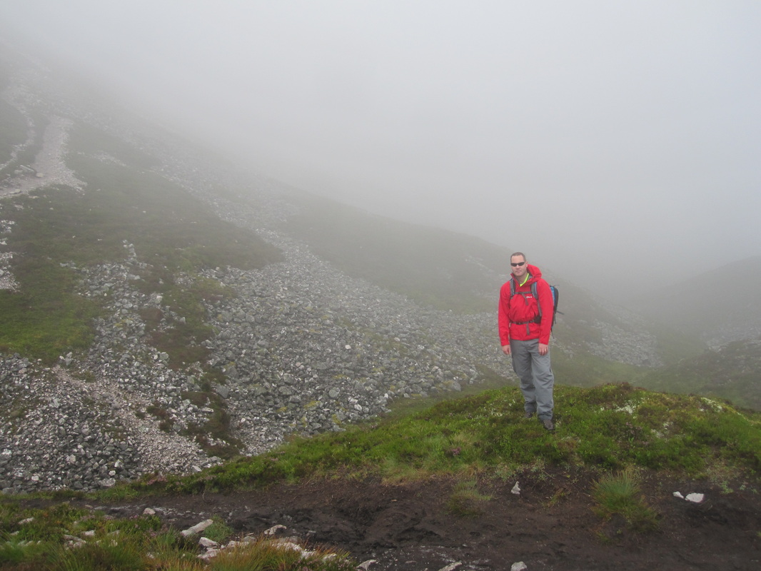
Again the area around this summit was covered in large irregular shaped boulders which made progress quite slow. It occured to me that given the distance back to the car I couldn't think of many places where I would less like to go over on my ankle, and that given the conditions and terrain I couldn't think of many places where it would be more likely !! We eventually cleared the boulders and followed the intermittent path toward and off the nose of the ridge. The descent is very steep and quite boggy back down into the glen.
Again the area around this summit was covered in large irregular shaped boulders which made progress quite slow. It occured to me that given the distance back to the car I couldn't think of many places where I would less like to go over on my ankle, and that given the conditions and terrain I couldn't think of many places where it would be more likely !! We eventually cleared the boulders and followed the intermittent path toward and off the nose of the ridge. The descent is very steep and quite boggy back down into the glen.
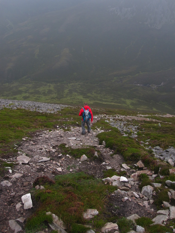
At last some green amidst the grey, descending from Airgiod Bheinn (shades 46-50)
We crossed over the burn and began the long walk back to the car. The stalkers path is boggy as described, however, I think it was considerably drier than it would usually be given the relatively dry summer we have had. At this point my left knee was 'louping' and I'd never been so relieved to find myself back on the flat track and heading back to the car. It was such a shame that we were denied what I imagine would be quite outstanding views, still we both enjoyed the long day and the new challenges it presented. 6,7 & 8 done.
 RSS Feed
